Inkerman Safe Travel Corridor
Location
Cost
Milestones
- Completion of civil detailed design27 July 2025
- Final approval from Department of Transport and Planning (DTP) – External Works Team 30 Oct 2025
- Completion of lighting design and service relocation works by CitiPower 28 Nov 2025
- Completion of public lighting installation and new electricity supply by CitiPower 1 July 2026
- Completion of procurement and Council approval for construction1 July 2026
- Construction commencement 1 Oct 2026
- Construction completion including project contingency period30 Nov 2027
Why are we doing this?
The Inkerman Safe Travel Corridor is the Council's highest priority cycling infrastructure project, identified in the Integrated Transport Strategy: Move, Connect, Live 2018–2028. It addresses growing transport and parking pressures by creating a safer and more attractive corridor for biking and walking. The project aims to shift short- to medium-distance trips to more sustainable modes, thereby reducing congestion, improving road safety, and supporting healthier, lower-impact travel options for the community.
The current layout of Inkerman Street has a high crash rate, with 31 reported crashes in the 5 years ending in June 2022, resulting in 14 serious injuries. The corridor has been redesigned between St Kilda Road and Hotham Street to introduce buffered bike lanes along Inkerman Street, raised pedestrian crossings with flashing lights, lower vehicle speeds, and enhanced landscaping. These upgrades aim to significantly improve safety, accessibility, and the overall livability of the corridor for all road users.
Council Endorsement for Project
In May 2024, Council endorsed proceeding to the detailed design and construction of Option B, which includes safety improvements through the introduction of on-road buffered bike lanes. This decision followed a seven-week community consultation period from 19 October to 7 December 2023, including a two-week extension. Community feedback was carefully considered, with the final design aiming to balance improved safety outcomes with minimising parking loss and associated impacts on local businesses.
The impact
The project will involve staged construction works along Inkerman Street between St Kilda Road and Hotham Street. During this period, temporary traffic changes will be in place, including reduced speed limits, partial lane closures, and parking restrictions. Pedestrian and vehicle access to properties will be maintained at all times, although minor delays may occur.
Advance notice will be provided to residents and businesses ahead of works, and traffic management plans will be implemented to ensure safety and minimise disruption.
Objectives
The Inkerman Safe Travel Corridor project will deliver a series of important upgrades that make the corridor safer, greener, and more accessible for everyone who uses it.
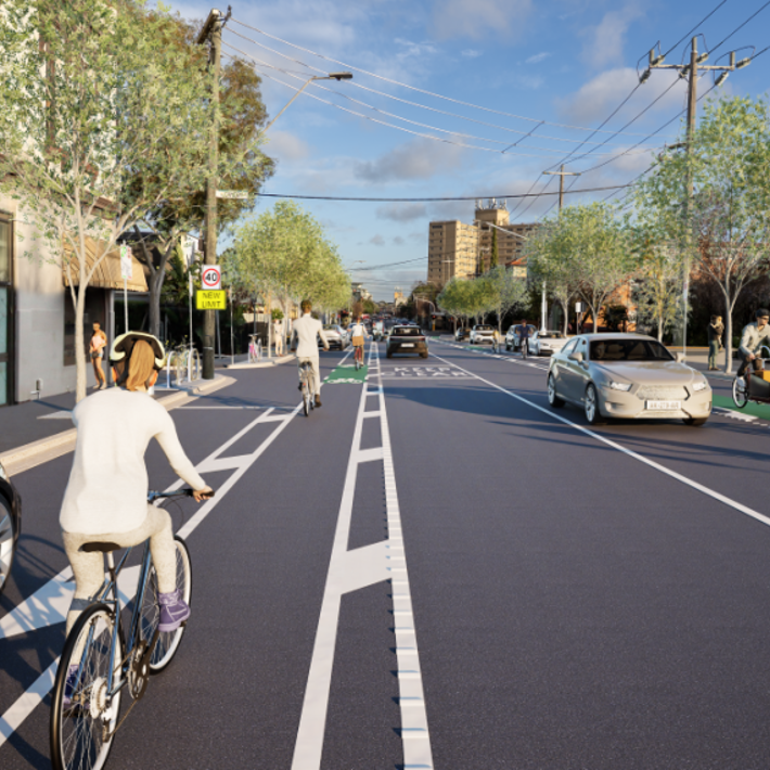
- Buffered on-road bike lanes will be installed along Inkerman Street between St Kilda Road and Hotham Street to create a safer, more comfortable route for people riding bikes. These lanes will separate cyclists from moving traffic and parked cars, encouraging more people to consider riding for local trips.
- To improve pedestrian safety, the project includes three new raised pedestrian crossings fitted with flashing lights. These crossings will provide safer points to cross the street, especially near shops, and public reserve.
- The project will also introduce a reduced speed limit along the corridor to enhance safety for vulnerable road users, including people walking and cycling. Lower speeds help reduce the risk and severity of crashes, supporting a safer and more livable street.
- Lighting, signage, and line marking will be upgraded across the corridor to the standards, improving visibility and clarity for all road users — particularly at night and in poor weather conditions.
- The streetscape will be enhanced through new tree planting and the integration of water-sensitive urban design (WSUD) features. These improvements will increase shade, support stormwater management, and contribute to a greener and more attractive public space.
- The project will improve overall accessibility and safety along the corridor for people walking, riding, and driving by creating clearer, more inclusive and better-connected infrastructure.
- To support local parking needs, parking bays will be widened to meet current design standards. This will make it easier and safer to park a broader range of vehicles along the corridor.
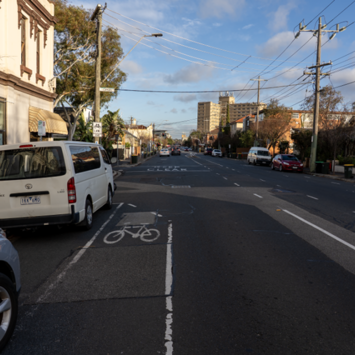
View 01: Marriott St and Inkerman St intersection looking towards west - BEFORE
View 01: Marriott St and Inkerman St intersection looking towards west -AFTER
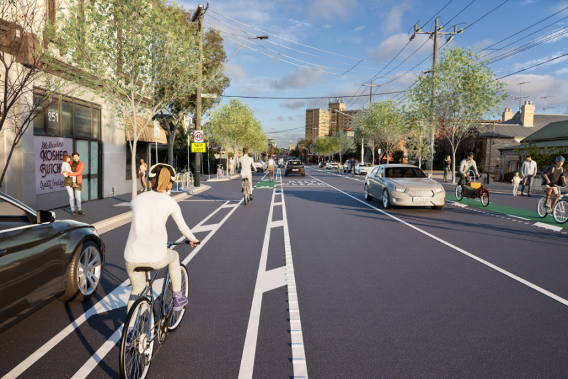
View 02: King St and Inkerman St intersection looking towards west - BEFORE
View 02: King St and Inkerman St intersection looking towards west - AFTER
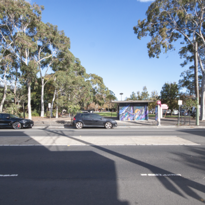
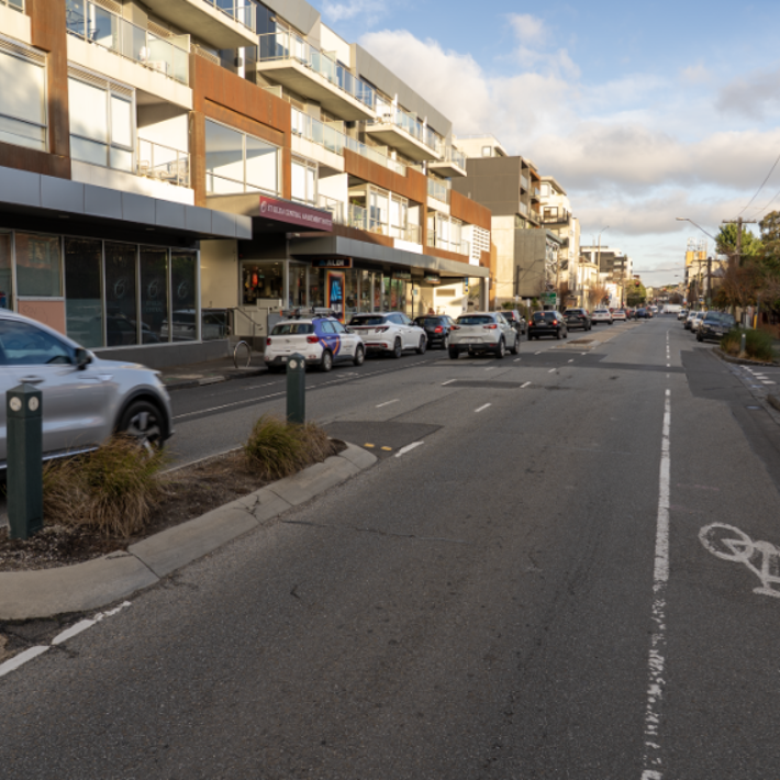
View 03: Opposite Hewison Reserve looking towards south - BEFORE
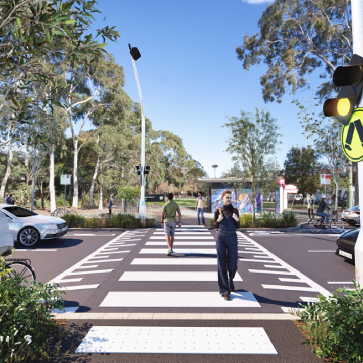
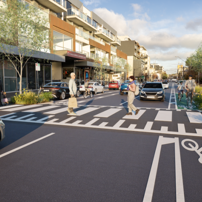
View 03: Opposite Hewison Reserve looking towards south - AFTER